2267Views 18Comments

Pakistan affirms plans to deploy earth observation satellite in 2018
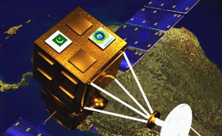
On October 04, Pakistan’s Space and Upper Atmosphere Research Commission (SUPARCO) confirmed that the Pakistan Remote Sensing Satellite (PRSS-1) will launch in March 2018.
The PRSS-1 will be Pakistan’s first earth observation satellite. Its primary role will be to support Pakistan’s development efforts, from monitoring geological and environmental events to supporting national tasks, such as disaster relief and monitoring areas of interest to the China Pakistan Economic Corridor (CPEC).
SUPARCO Chairman Qaiser Anees Khurram told Gulf News that the PRSS-1 “will make Pakistan self-reliant in multi-spectral imaging.” It will also free Pakistan from relying on foreign image providers, thus providing major savings in foreign currency use to the public exchequer.
The PRSS-1 will join the PakSat-1R, a communications satellite that was launched in 2011.
As per Khurram, the PakSat-1R “is up and running with efficient provision of communication and broadcast services … in the country and neighbouring regions.”
According to SUPARCO, the PRSS-1 will comprise of an electro-optical (EO) system as well as a synthetic aperture radar (SAR). The SAR payload will enable the PRSS-1 to take high-resolution photos.
SUPARCO had signed a development and launch agreement for the PRSS-1 with China Great Wall Industry Cooperation (CGWIC) in April 2016. Ahsan Iqbal, who was then the Planning, Development and Reform Minister, told news outlets that the contract would facilitate the transfer of space technology to Pakistan.
Iqbal had also alluded that the PRSS-1 would contribute to Pakistan’s national security interests, especially in terms of border security and surveillance. The PRSS-1 was scheduled for launch in June 2016, but it now appears that the launch-date was moved-up.
Notes & Comments:
Work towards securing an earth observation satellite began in the late 1990s under the Earth Observation Satellite System (EOSS) program. SUPARCO had intended to deploy the EOSS – which was re-designated to the Remote Sensing Satellite System (RSSS) and then PRSS-1 – by 2015 or 2016.
The PRSS-1 was envisaged as a domestic program developed with technical support from credible foreign satellite manufacturers and solutions providers. There have been hints that the PRSS-1 could be available for intelligence, surveillance and reconnaissance (ISR) needs, specifically image intelligence (IMINT).
This avenue certainly has its proponents, most recently Pakistan’s former ambassador to the U.N Munir Akram, who advocated that Pakistan build its ISR net through “satellites, surveillance aircraft and drones.” Though the PRSS-1 – or a follow-on to the PRSS – could provide IMINT, Pakistan has yet to signal intent for a military satellite communications (SATCOM) platform, which would enable it to operate unmanned aerial vehicles (UAV) at beyond-line-of-sight range. This would occur by deploying a satellite with X-band transponders.


18 Comments
by Jack More
By china,from china,with china.Good development indeed.
by Jigsaw
Too little , too late.
by Lasit
SUPARCO should try ISRO, its more reliable and cheaper than what chinese can offer for LOE launches
by Amir Ali Shah
No shame in having the technology from anywhere. Also remember that Pakistan was launching its own Rockets from Somyani beaches in Karachi way back in 1962 when India still hadn’t done so!
by U
Why is it too late?
Isn’t it better to have something than nothing…
by Jigsaw
I think it’s clear that Pakistan is severely lacking in this area but even this one little launch is enough to have Indians come out fuming in their despair and spite. It’s really next to nothing and possibly because it’s mainly in the folds of the civilian gov to drive this area whereas the military is getting is requirements fulfilled with Beidou constellation and other Chinese military sats. We might see a difference if the Pakistani military takes over Pakistan’s satellite programme. They probably don’t see it necessary to Pakistan’s military requirements.
by Headstrong
Like that’s going to happen 😄
Remember they turned down a freebie
by mazhar
For USA missiles and rocket development, remember one name, Wernher von Braun, a German national “captured” from Pena Munda, Germany was head of German V1/V2 Rocket program. USA would have not be able to land on moon without Braun.(if they really landed there). Most of the modern military hardware points it’s origin to Germany.
by Stan
Why is that bothering you Jack
by TZK
They should not put all their eggs in one basket and must develop independent capability even with cast iron friendships. China is a friend for the time being but changes in PRC domestic politics or geopolitics cannot be predicted.
by SP
This will be a big jump for Pakistan, however 1 satellite is not enough. Pakistan requires many satellites to fully meet its expanding needs.
by Khan Majeed
SUPARCO is almost a useless organisation
by Jack More
I mean really.I though US aids were real thing.
by Headstrong
I suppose the name of the donor matters. If it’s Iron Brother, the amount of water won’t matter 😄
by Stan
Yes the name of donor matters ,by the way check who is the number one aid recipient of United States since 1947🤣
by Headstrong
I will. In the meantime, check who’s been the largest recipient of aid with regard to GDP and population. Hint – that country still seeks aid constantly (and is expected to ‘reach out’ again very soon as its Iron Brother will not give aid and grants but only loans) while others who’ve been independent as long have entirely stopped 😄
by Stan
While you are in the checking mode also check who owes$500 billion in South Asia and who owes $67 billion in South Asia 😀💰💰💰💰
by Omar Munir
LOL